
�������: 31-45 ���鵽������ѧ���� GIS����ؼ�¼1083�� . ��ѯʱ��(0.282 ��)
�Ͼ���ҵ��ѧ2019��˶ʿ���Ե�����Ϣϵͳ��GIS��ԭ����١�
2018��8��1��-4�գ�ȫ����У��Web GISԭ���뼼�����γ����ֻ�����У������滮ѧԺ��¥���������С�������Esri�й����ߵȽ��������硢���ϴ�ѧ�������죬���ϴ�ѧ������滮ѧԺ�а졣����������Ϣ��ѧר�������Ժʿ������ҫԺʿ����������ϵͳ�о�����Esri����Ŀ���ܡ����ʻ��˵�����Ϣ��ѧЭ�ᣨCPGIS��ǰ����ϯ��Ʒ�½��ڣ�Esri�й������ܲá���ϯ��ѯר�Ҳ�����������ʦ������ר�Ҳ̾�����...
EVALUATION OF RESOURCES CARRYING CAPACITY IN CHINA BASED ON REMOTE SENSING AND GIS
carrying capacity CCRR model modification remote sensing
<
2018/5/15
This paper accurately extracted the information of arable land, grassland (wetland), forest land, water area and construction land, based on 1 : 250000 basic geographic information data. I...
����GIS������ʡ�ɺ��ֺ���������������
�ɺ��ֺ� �������� ����ʡ ����
<
2018/4/18
�ڷ�������ʡ�ɺ��ֺ���������ᾭ�û����Ļ����ϣ�����ֺ�ѧ������ۣ�����������Σ���ԡ����ֻ��������ԡ������屩¶�ԡ����ּ�������4����ϵͳѡȡָ�꣬�����ɺ��ֺ���������ģ�͡���������ʡ������̬����ᾭ�����ݣ�����GIS�ռ����ݷ������ܽ��ɺ�����Ȼ���������ͳһ�������иɺ��ֺ����������������������������1����������Σ���Եȼ������Ա����ϵݼ����ƣ�Σ���Եȼ���ߵ������֣�������Ӱ���ͭ��������...
IMPLEMENTING GIS TO IMPROVE HOSPITAL EFFICIENCY IN NATURAL DISASTERS
Disaster management GIS Hospital Mitigation Natural disasters Preperdness
<
2018/4/18
Over the past decades, the number of natural disasters has been growing around the world. In addition to damaging communities and infrastructures, unexpected disasters also affect service providers su...
IMPLEMENTING GIS TO IMPROVE HOSPITAL EFFICIENCY IN NATURAL DISASTERS
Disaster management GIS Hospital Mitigation Natural disasters Preperdness
<
2018/5/8
Over the past decades, the number of natural disasters has been growing around the world. In addition to damaging communities and infrastructures, unexpected disasters also affect service providers su...
REMOTE SENSING & GIS INTEGRATION FOR MONITORING THE AREAS AFFECTED BY FOREST FIRES: A CASE STUDY IN IZMIR, TURKEY
Remote Sensing Forest Fire Burn Indexes Classification Sentinel Landsat DEM
<
2018/5/8
A forest fire is stated as an ecological disaster whether it is man-made or caused naturally. İzmir is one of the regions where forest fires are most intensified in Turkey. The study area located...
APPLICATION OF GIS AND REMOTE SENSING TO MONITOR THE IMPACT OF DEVELOPMENT ACTIVITIES ON THE COASTAL ZONE OF JAZAN CITY ON THE RED SEA, SAUDI ARABIA
Urbanization Edge images Urban Land Use Infrastructure Growth Multi-Temporal Landsat
<
2018/4/18
Jazan city is a fast-growing coastal city in the southern part of Saudi Arabia, Red Sea. Recently, it has encountered quick industrial development activities. To monitor these activities, the changes ...
DEVELOPING GIS-BASED DISASTER MANAGEMENT SYSTEM FOR LOCAL AUTHORITY �C CASE STUDY IN MALAYSIA
GIS Map publishing Disaster management
<
2018/4/18
This paper describes the development of geospatial-based disaster management system for an agency at regional level. Important aspects of the system such as spatial data, geospatial database, interfac...
APPLICATION OF GIS AND REMOTE SENSING TO MONITOR THE IMPACT OF DEVELOPMENT ACTIVITIES ON THE COASTAL ZONE OF JAZAN CITY ON THE RED SEA, SAUDI ARABIA
Urbanization Edge images Urban, L Use Infrastructure Growth Multi-Temporal Landsat
<
2018/5/8
Jazan city is a fast-growing coastal city in the southern part of Saudi Arabia, Red Sea. Recently, it has encountered quick industrial development activities. To monitor these activities, the changes ...
THE XII CENTURY TOWERS, A BENCHMARK OF THE ROME COUNTRYSIDE ALMOST CANCELLED: THE SAFEGUARD PLAN BY LOW COST UAV AND TERRESTRIAL DSM PHOTOGRAMMETRY SURVEYING AND 3D WEB GIS APPLICATIONS
XII century towers Rome Mid-Age countryside Cultural Heritage preservation close-range photogrammetry UAV photogrammetry integrated survey low-cost action camera GPS Web GIS 2D and 3D
<
2018/3/5
This is the consequence of the phenomenon identified with the ��Incasalamento�� neologism, described in depth in the following paper, intended as the general process of expansion of the urban society in...
�о���ͬˮ����ֲ��ʩ��Ч�����죬ּ�ڼ�ǿ���ʾ����ֹ����������������ͷ���Ч�ʣ��Ӷ�����ũ�ﵪ�ŷš���������ͨ����2005��2013�꼪��ʡ�����䷽ʩ����������в�ʩ���ʴ�����N0P2K2����3�����ݶȣ�0.5N2P2K2������N2P2K2������1.5N2P2K2���������з������о���ͬˮ����ֲ���IJ���������ʩ��Ч��������ũѧ�����ʣ�̽�ָ�����ʩ��Ч��������DZ���������������ʡ������ˮ����������...
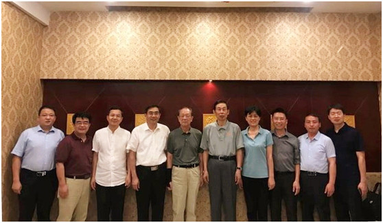
������������ʡ��������Ϣѧ��GIS����ͼרҵίԱ��2017��ѧ������ߡ����������⼼��������Ӧ�á�ѧ�����ֻ����ĵ�֪ͨ
����ʡ��������Ϣѧ��GIS����ͼרҵίԱ�� 2017�� ѧ����� ���������⼼��������Ӧ�� ѧ�����ֻ� ����
<
2017/9/22
���ŵ�һ�ε��������ղ鹤����˳����ɣ���ʡ����������Ŀ������ʱ����Ϊ��һ���ٽ���ʡ���������ղ�����ɹ���Ӧ�ã��ڸ���������ר���Ե�����������о�������ʡ��������Ϣѧ��GIS����ͼרҵίԱ�ᣨ���¼�ơ�GISרί�ᡱ������10������Ѯ��֯�ٿ�2017���ѧ������ߡ����������⼼��������Ӧ�á�ѧ�����ֻᡣΪ��ϱ������ֻ��˳���ٿ���GISרί����������������ԡ����������⼼��������Ӧ...
INTEGRATED USE OF REMOTE SENSING, GIS AND GPS TECHNOLOGY FOR MONITORING THE ENVIRONMENTAL PROBLEM OF SHYAMNAGAR
Environmental disaster Shrimp Agriculture Remote Sensing GIS GPS Classifications
<
2017/7/12
Cultivation of shrimp mostly in unplanned way has been considered as one of the major environmental disasters of Shamnagar. Villagers surrounding the rivers are mainly involved with fish (shrimp) cult...
�й��о����������а�-��
- ���ڼ���...
�й�ѧ���ڿ����а�-��
- ���ڼ���...
�����ѧ���л������а�-��
- ���ڼ���...
�й���ѧ���а�-��
- ���ڼ���...
�ˡ���-ƪ
- ���ڼ���...
�Ρ���-ƪ
- ���ڼ���...
��������-ƪ
- ���ڼ���...
�������� -ƪ
- ���ڼ���...
֪ʶҪ��-ƪ
- ���ڼ���...
���ʶ�̬-ƪ
- ���ڼ���...
��������-ƪ
- ���ڼ���...
ѧ��ָ��-ƪ
- ���ڼ���...
ѧ��վ��-ƪ
- ���ڼ���...