
搜索结果: 16-30 共查到“理学 GIS”相关记录290条 . 查询时间(0.183 秒)
Fundamentals of GIS for ecology and species distribution modeling workshop
Fundamentals of GIS for ecology and species distribution modeling workshop
<
2017/3/10
GIS skills are essential to modern day ecologists. No matter what their specialism ecologists have had to acknowledge that species, and ecological phenomena occur in the real world, and that the relat...
基于GIS的秦巴山区土地生态敏感性评价――以陇南山区为例
生态敏感性 GIS 趋势面分析 陇南市
<
2017/11/23
生态环境敏感性评价是进行生态功能区划的前提条件,也是判断生态系统稳定性的重要手段。进行土地生态环境敏感性评价,是落实科学发展观和生态文明理念,加快实施主体功能区规划和建设国家生态安全屏障的重要举措,对推动陇南市可持续发展和维护国家生态安全具有重要意义。本文根据陇南市山地生态系统基本特征,运用GIS技术,从土壤侵蚀、石漠化、和地质灾害三个方面对陇南市土地生态敏感性展开单因子评价和综合评价,并对综合评...
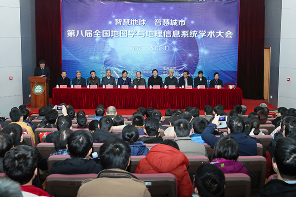
2016年11月25至28日,第八届全国地图学与GIS学术大会在南京师范大学举行。本届大会由中国测绘地理信息学会地图学与GIS专业委员会、中国地理学会地图学与GIS专委会、中国地理信息产业协会地图工作委员会、中国地质学会地质制图与地理信息专委会、中国自然资源学会资源制图专委会五家联合主办,由南京师范大学及省遥感与GIS学会、省测绘地理信息学会、省地理信息资源开发与利用协同创新中心、虚拟地理环境教育...
INTEGRATING MULTIPLE CRITERIA EVALUATION AND GIS IN ECOTOURISM: A REVIEW
Ecotourism Development Multiple Criteria Evaluation Analytic Hierarcy Process GIS
<
2016/10/14
The concept of 'Eco-tourism' is increasingly heard in recent decades. Ecotourism is one adventure that environmentally responsible intended to appreciate the nature experiences and cultures. Ecotouris...
BEYOND FLOOD HAZARD MAPS: DETAILED FLOOD CHARACTERIZATION WITH REMOTE SENSING, GIS AND 2D MODELLING
Flood Hazards LiDAR Flood Simulation HEC RAS 2D Modelling
<
2016/10/14
Flooding is considered to be one of the most destructive among many natural disasters such that understanding floods and assessing the risks associated to it are becoming more important nowadays. In t...
GIS DATA COLLECTION FOR PEDESTRIAN FACILITIES AND FURNITURE USING MAPINR FOR ANDROID
GIS spatial data collection Mobile GIS smartphones android MAPInr
<
2016/10/14
Mobile GIS is introduced to reduce the time taken in completing the field data collection procedure. With the expansion of technology today, mobile GIS is not far behind. It can be integrated with the...
IDENTIFYING HIGH-RISK POPULATIONS OF TUBERCULOSIS USING ENVIRONMENTAL FACTORS AND GIS BASED MULTI-CRITERIA DECISION MAKING METHOD
GIS Index Model Spatial MCDM Risk Map Shah Alam Tuberculosis Environment
<
2016/10/14
Development of an innovative method to enhance the detection of tuberculosis (TB) in Malaysia is the latest agenda of the Ministry of Health. Therefore, a geographical information system (GIS) based i...
ON-LINE INTEGRATION OF GIS AND GPS FOR AUTOMATIC AND INTELLIGENT UPDATING OF SPATIAL DATA
Automatic GPS GIS Integrated Systems Rule-based system spatial data Updating
<
2015/9/28
One of the most expensive stages in implementation of a GIS system is preparation of spatial data to be entered to the system. It can be said that about 60-80 percent of the project cost is spent for ...
Effects of the 6th September 2002 earthquake: damage amplification in the south-eastern sector of Palermo explained by GIS technology
GIS seismic response site effects Palermo
<
2015/9/17
During the 6th September 2002 earthquake the highest damage level in Palermo was observed in the SE sector.
This is a recent urbanization area where reinforced concrete structures predominate. A deta...
LAV@HAZARD: a web-GIS interface for volcanic hazard assessment
Volcanic hazard Web-GIS Decision support system
<
2015/8/27
Satellite data, radiative power of hot spots as measured with remote sensing, historical records, on site geological surveys, digital elevation model data, and simulation results together provide a ma...
E-LEARNING COURSES FOR GIS AND REMOTE SENSING IN GERMANY STATUS AND PERSPECTIVES
Education Online learning E-learnin Training
<
2015/8/24
E-learning can play a vital role in providing suitable and effective learning environments to enhance the knowledge and skills of
students. The paper will begin with an analysis of the recent e-lear...
A GIS-based application for volume estimation and spatial distribution analysis of tephra fallout: a case study of the 122 BC Etna eruption
Geographic Information System (GIS) Tephra fallout Volume estimation Etna
<
2015/8/18
In this study, we demonstrate the use of a geo-spatial information system for volume estimation of fallout deposits and for identification of syn-eruptive and post-eruptive depositional mechanisms. Fo...
SWAMP GIS: A spatial decision support system for predicting and treating stormwater runoff
Stormwater runoff decision support
<
2015/8/14
SWAMP GIS is a spatially-based decision support system that empowers users in rural areas within Oregon (USA) with tools for predicting and mitigating stormwater runoff. SWAMP GIS is made freely avail...
Flood susceptible mapping and risk area delineation using logistic regression, GIS and remote sensing
Flood susceptibility analysis logistic regression model
<
2015/8/14
Recently, in the year 2006, 2007 and 2008 heavy monsoons rainfall have triggered floods along Malaysia's east coast as well as in different parts of the country. The hardest hit areas are along the ea...
Watershed Modeling Using GIS Technology: A Critical Review
Geographic Information System GIS hydrologic processes modeling watershed sensing
<
2015/8/14
Understanding and managing water resource problems involves complex processes and interactions within the watershed surface and subsurface. The imposition of total maximum daily load (TMDL) regulation...