
�������: 1-15 ���鵽��Land Cover Change����ؼ�¼44�� . ��ѯʱ��(0.272 ��)
THE LAND-USE AND LAND-COVER CHANGE ANALYSIS IN BEIJING HUAIROU IN LAST TEN YEARS
Land-use and Land-cover Change Analysis Remote sensing technology Beijing Huairou ECognition
<
2018/5/16
With eCognition software, the sample-based object-oriented classification method is used. Remote sensing images in Huairou district of Beijing had been classified using remote sensing images of last t...
LAND COVER CHANGE MONITORING OF TYPICAL FUNCTIONAL COMMUNITIES OF SICHUAN PROVINCE BASED ON ZY-3 DATA
Land Cover ZY-3 Functional Communities Sichuan Province
<
2018/5/14
According to the function, land space types are divided into key development areas, restricted development areas and forbidden development areas in Sichuan Province. This paper monitors and analyses t...
LAND USE/LAND COVER CHANGE DETECTION USING MULTI�CTEMPORAL SATELLITE DATASET: A CASE STUDY IN ISTANBUL NEW AIRPORT
Multi-temporal satellite dataset Land Use/Land Cover Landsat-8 Sentinel 2A Change detection
<
2018/4/18
In recent years, especially in metropolitan cities such as Istanbul, the emerging needs of the increasing population and demand for better air transportation capacity have led to big environmental cha...
LAND USE/LAND COVER CHANGE DETECTION USING MULTI�CTEMPORAL SATELLITE DATASET: A CASE STUDY IN ISTANBUL NEW AIRPORT
Multi-temporal satellite dataset Land Use/Land Cover Landsat-8 Sentinel 2A Change detection
<
2018/5/8
In recent years, especially in metropolitan cities such as Istanbul, the emerging needs of the increasing population and demand for better air transportation capacity have led to big environmental cha...
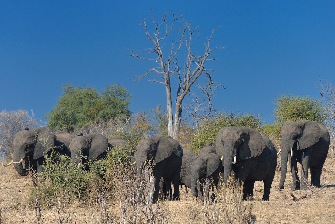
Virginia Tech researchers explore causes of land cover change in African savannas��ͼ��
Virginia Tech researchers land cover change African savannas
<
2017/11/23
A new study by Virginia Tech researchers tracks land cover changes in the Chobe district of Northern Botswana and provides information that will allow governments and nonprofit organizations to improv...
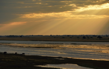
Land cover change in Botswana savannas:Don't blame the elephants��ͼ��
Land cover change Botswana savannas Don't blame the elephants
<
2017/11/23
Why are drylands changing in the Chobe district of Northern Botswana? A new study tracks differences in the savanna there across 30 years, and provides information that will allow governments and non-...
COMPARISON OF PIXEL-BASED AND OBJECT-ORIENTED LAND COVER CHANGE DETECTION METHODS
Land Cover Change Detection Pixel-based Segmentation scale Object-oriented 30m resolution
<
2016/11/23
Change detection method is an efficient way in the aim of land cover product updating on the basis of the existing products, and at the same time saving lots of cost and time. Considering the object-o...
LAND COVER CHANGE DETECTION USING SALIENCY ANDWAVELET TRANSFORMATION
Change detection Saliency detection Local entropy Wavelet transformation
<
2016/11/23
How to obtain accurate difference map remains an open challenge in change detection. To tackle this problem, we propose a change detection method based on saliency detection and wavelet transformation...
TRAJECTORY-BASED ANALYSIS OF URBAN LAND-COVER CHANGE DETECTION
change trajectory similarity index long time series Landsat
<
2016/11/23
China have occurred unprecedented urban growth over the last two decades. It is reported that the level of China��s urbanization increased from 18 % in 1978 to 41 % in 2003, and this figure...
THE CLASSICAL ASSUMPTION TEST TO DRIVING FACTORS OF LAND COVER CHANGE IN THE DEVELOPMENT REGION OF NORTHERN PART OF WEST JAVA
Land Cover Change Driving Factors Classical Assumption Test Binary Logistic Regression
<
2016/11/15
Land cover changes continuously change by the time. Many kind of phenomena is a simple of important factors that affect the environment change, both locally and also globally. To determine the existen...
AN OBJECT-ORIENTED APPROACH TO URBAN LAND COVER CHANGE DETECTION
Remote Sensing Urban Change Detection Segmentation Hierarchical Multitemporal
<
2016/1/3
Over the past decades, most of the remote sensing studies dealt with natural environment. The advance of remote sensing satellites and the innovative methods of proceeding high resolution images have ...
AUTOMATIC LAND COVER CHANGE DETECTION BASED ON IMAGE ANALYSIS AND QUANTITATIVE METHODS
Land Cover Parcel-knowledge Automatic Change Detection Integrated
<
2016/1/3
The methods of Automatic land use and land cover change detection based on remote sensing image has been widely applied in research for LUCC (Land Use and Cover Change), nature resource management and...
RECENT DEVELOPMENTS IN LANDSAT-BASED CONTINENTAL SCALE LAND COVER CHANGE MONITORING IN AUSTRALIA
Remote Sensing Land Cover Monitoring Multi-temporal Landsat Forestry
<
2016/1/3
Land use changes associated with agriculture and forestry are a significant component in Australia��s carbon budget. In response to the need to quantify the resulting greenhouse gas emissions, the capa...
LONG TERM LAND USE AND LAND COVER CHANGE AND ITS IMPACT ON COOL TEMPERATE RAINFOREST IN THE STRZELECKI RANGES,AUSTRALIA
Land use Land cover Photogrammetry Orthoimage Change detection Vegetation Rainforest
<
2015/12/31
The Australian landscape, as in many countries, has undergone a significant change. The extent of native forests in Australia has steadily decreased over time since European settlement. The establishm...
MULTITEMPORAL SPOT IMAGES FOR URBAN LAND-COVER CHANGE DETECTION OVER STOCKHOLM BETWEEN 1986 AND 2004
Multitemporal SPOT Urban Land-cover Change Detection
<
2015/12/23
The overall objective of this research is to detect new urban areas over Stockholm Region between 1986 and 2004 using multitemporal remote sensing. Two SPOT images acquired on 13th of June 1986and 29t...
�й��о����������а�-��
- ���ڼ���...
�й�ѧ���ڿ����а�-��
- ���ڼ���...
�����ѧ���л������а�-��
- ���ڼ���...
�й���ѧ���а�-��
- ���ڼ���...
�ˡ���-ƪ
- ���ڼ���...
�Ρ���-ƪ
- ���ڼ���...
��������-ƪ
- ���ڼ���...
�������� -ƪ
- ���ڼ���...
֪ʶҪ��-ƪ
- ���ڼ���...
���ʶ�̬-ƪ
- ���ڼ���...
��������-ƪ
- ���ڼ���...
ѧ��ָ��-ƪ
- ���ڼ���...
ѧ��վ��-ƪ
- ���ڼ���...