
搜索结果: 1-3 共查到“测绘科学技术 satellite imaging”相关记录3条 . 查询时间(0.383 秒)
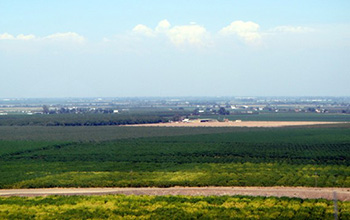
Researchers use satellite imaging to map groundwater use in California's Central Valley(图)
satellite imaging map groundwater California Central Valley
<
2020/10/16
Researchers at the University of California, San Diego report a new way to improve groundwater monitoring by using a remote sensing technology, known as InSAR (interferometric synthetic aper...
HIGH-RESOLUTION SATELLITE IMAGING FOR DIGITAL SURFACE MODELS
High resolution mapping satellite imagery SPOT5 stereo
<
2015/8/17
Elevation information is an important component of any geospatial database. It is imperative for applications such as
topographic mapping, spatial and temporal change detection, feature extraction a...
GIS WEB SERVICES AND SATELLITE IMAGING AS A FRAMEWORK FOR ENVIRONMENTAL MONITORING: THE DESIGN AND IMPLEMENTATION OF A VEGETATION INDICES CALCULATION TEST CASE
Spatial Information Sciences GIS Internet/Web Interoperability Imagery Satellite Global-EnvironmentalDatabases
<
2015/6/1
GIS web services bring to the Geographic information arena the promise to deliver algorithmic implementations and data services to the broader community, following a simple yet powerful paradigm. Unde...