
�������: 1-15 ���鵽������ѧ���� Use����ؼ�¼325�� . ��ѯʱ��(0.173 ��)
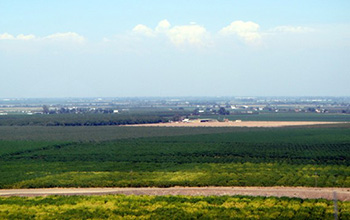
Researchers use satellite imaging to map groundwater use in California's Central Valley��ͼ��
satellite imaging map groundwater California Central Valley
<
2020/10/16
Researchers at the University of California, San Diego report a new way to improve groundwater monitoring by using a remote sensing technology, known as InSAR (interferometric synthetic aper...
CONSIDERATIONS ON THE USE OF DIGITAL TOOLS FOR DOCUMENTING ANCIENT WALL GRAFFITI
Digital Photogrammetry RTI Wall Graffiti Heritage Documentation
<
2019/3/4
Ancient graffiti are a valuable and constant historical evidence through the human history, regardless from the geographic area or historical period. They can be found on different kinds of surfaces a...
A REVIEW OF 3D GIS FOR USE IN CREATING VIRTUAL HISTORIC DUBLIN
Historic City Modelling GIS HBIM Laser Scanning
<
2019/3/1
This paper illustrates how BIM integration with GIS is approached as part of the workflow in creating Virtual Historic Dublin. A design for a WEB based interactive 3D model of historic buildings and c...
CONSIDERATIONS ON THE USE OF SENTINEL-1 DATA IN FLOOD MAPPING IN URBAN AREAS: ANKARA (TURKEY) 2018 FLOODS
Flood Mapping Hazard Risk Sentinel Ankara (Turkey)
<
2019/2/28
Flood events frequently occur due to -most probably- climate change on our planet in the recent years. Rapid urbanization also causes imperfections in city planning, such as insufficient consideration...
LAND USE CLASSIFICATION FROM COMBINED USE OF REMOTE SENSING AND SOCIAL SENSING DATA
Human Behavior Social Sensing Remote Sensing Decision Tree Geographic Information System Accuracy Assessment
<
2018/11/9
Large amounts of data can be sensed and analyzed to discover patterns of human behavior in cities for the benefit of urban authorities and citizens, especially in the areas of traffic forecasting, urb...
AN EXPLORATORY STUDY OF CIVIL SERVANTS SPATIAL THINKING, AWARENESS AND USE OF MAPS IN AFRICA-NIGERIA
Space Spatial thinking Map Civil servants Nigeria
<
2018/5/11
The paper is an exploratory study of spatial thinking, awareness and use of maps among civil servants in Nigeria with a view towards enhancing capacity building in the development and use of global ma...
USE OF FISHEYE PARROT BEBOP 2 IMAGES FOR 3D MODELLING USING COMMERCIAL PHOTOGRAMMETRIC SOFTWARE
Fisheye Distortions Camera Calibration Parrot Bebop 3D modelling Agisoft PhotoScan Pix4D Mapper
<
2018/6/4
Fisheye camera installed on-board mass market UAS are becoming very popular and it is more and more frequent the use of such platforms for photogrammetric purposes. The interest of wide-angles images ...
INVESTIGATION INTO THE USE OF ACTION CAMERAS IN THE DOCUMENTATION OF ARCHITECTURAL DETAILS �C THE CASE STUDY OF A BAROQUE CHAMBER
low-cost photogrammetry Xiaomi camera accuracy shape analysis cultural heritage frescoes
<
2018/6/4
In this paper the possibility of using the Xiaomi 4K action cameras as a low-cost sensor for the generation of high resolution documentation of architecture and architectural elements in the field of ...
IMPROVING SPHERICAL PHOTOGRAMMETRY USING 360�� OMNI-CAMERAS: USE CASES AND NEW APPLICATIONS
Spherical Photogrammetry Equirectangular Panoramas 360�� omni-camera Architectural Heritage Dissemination
<
2018/6/4
During the last few years, there has been a growing exploitation of consumer-grade cameras allowing one to capture 360�� images. Each device has different features and the choice should be entrusted on...
INTEGRATED USE OF REMOTE SENSED DATA AND NUMERICAL CARTOGRAPHY FOR THE GENERATION OF 3D CITY MODELS
3D City Model Numerical cartography SmartCity Data fusion SfM Oblique imagery LiDAR
<
2018/6/4
3D city models are becoming increasingly popular and important, because they constitute the base for all the visualization, planning, management operations regarding the urban infrastructure. These da...
APPLYING RANDOM FOREST CLASSIFICATION TO MAP LAND USE/LAND COVER USING LANDSAT 8 OLI
Classification Landsat 8 OLI Land use Land cover Random Forest Decision Tree
<
2018/5/8
This study used the Random Forest classifier (RF) running in R environment to map Land use/Land cover (LULC) of Dak Lak province in Vietnam based on the Landsat 8 OLI. The values of two RF parameters ...
LAND USE/LAND COVER CHANGE DETECTION USING MULTI�CTEMPORAL SATELLITE DATASET: A CASE STUDY IN ISTANBUL NEW AIRPORT
Multi-temporal satellite dataset Land Use/Land Cover Landsat-8 Sentinel 2A Change detection
<
2018/4/18
In recent years, especially in metropolitan cities such as Istanbul, the emerging needs of the increasing population and demand for better air transportation capacity have led to big environmental cha...
HIGH-QUALITY 3D MODELS AND THEIR USE IN A CULTURAL HERITAGE CONSERVATION PROJECT
Glazed terracotta Photogrammetry Orthophoto Mesh Model Virtual restoration
<
2017/8/31
Cultural heritage digitization and 3D modelling processes are mainly based on laser scanning and digital photogrammetry techniques to produce complete, detailed and photorealistic three-dimensional su...
INTEGRATED USE OF REMOTE SENSING, GIS AND GPS TECHNOLOGY FOR MONITORING THE ENVIRONMENTAL PROBLEM OF SHYAMNAGAR
Environmental disaster Shrimp Agriculture Remote Sensing GIS GPS Classifications
<
2017/7/12
Cultivation of shrimp mostly in unplanned way has been considered as one of the major environmental disasters of Shamnagar. Villagers surrounding the rivers are mainly involved with fish (shrimp) cult...
VEGETATION ANALYSIS AND LAND USE LAND COVER CLASSIFICATION OF FOREST IN UTTARA KANNADA DISTRICT INDIA THROUGH GEO-INFORMATICS APPROACH
Forest software LULC class NDVI aspect altitude classification imageries
<
2017/7/12
The study was conducted in Uttara Kannada districts during the year 2012�C2014. The study area lies between 13.92�� N to 15.52�� N latitude and 74.08�� E to 75.09�� E longitude with...
�й��о����������а�-��
- ���ڼ���...
�й�ѧ���ڿ����а�-��
- ���ڼ���...
�����ѧ���л������а�-��
- ���ڼ���...
�й���ѧ���а�-��
- ���ڼ���...
�ˡ���-ƪ
- ���ڼ���...
�Ρ���-ƪ
- ���ڼ���...
��������-ƪ
- ���ڼ���...
�������� -ƪ
- ���ڼ���...
֪ʶҪ��-ƪ
- ���ڼ���...
���ʶ�̬-ƪ
- ���ڼ���...
��������-ƪ
- ���ڼ���...
ѧ��ָ��-ƪ
- ���ڼ���...
ѧ��վ��-ƪ
- ���ڼ���...